4.2
5 review
Everyone
Content rating
1.1K
Downloads


About this product
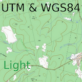
US AeroNav Charts for Trekarta description
Online maps plugin for Trekarta. Requires Trekarta to be installed.Adds support for Chartbundle US AeroNav Online Charts:
• Sectional Charts
• Terminal Area Charts
• World Aeronautical Charts
• IFR Enroute Low Charts
• IFR Enroute High Charts
• IFR Area Charts
Original disclaimer
These products are derived from official FAA data but are not themselves official navigation products. Use of these products is at users own risk. All charts have been reprojected, distances and angles measured on them may not match reality.
How to access
To get access to maps install this plugin, restart Trekarta and press Maps button to select a map. Maps cover only US area.
Online maps are cached by Trekarta. It means you need internet access to view them, but all viewed areas can be later accessed without internet connection.
Offline maps
These maps can be saved for offline use from the corresponding page. Select MBTiles format, save file to your device and then import it to Trekarta by selecting downloaded file in file manager.
For more information visit: http://www.chartbundle.com/charts/