UK Map for biking & hiking description
Great Britain Topographic Map is composed from OS Open data vector layers and OpenStreetMap features. The app is very handy if you need to use GPS on hiking trails or off trails, hunting activities and wild games in rural areas, Kayak and canoe treks, Search and Rescue (SAR) activities, fishing, re-touring or following roads diversions.All without cell coverage when you upgrade to the full version.
This application is a 7 day trial and it can be converted to full version after the test period.
Upgrading the app to full version gives you the option to download offline map, so the app is fully functional in remote areas without Internet access or cell reception.
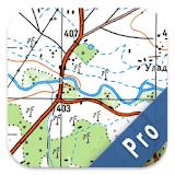
GBTopoMap is capable of displaying coordinates in geographic or projected form including British National Grid.
This app is working great as a quick tool for location reference.
Core functionality:
- Map data is available anywhere without cell reception and Internet access
- Possibility to add, remove, edit waypoints and group them into categories.
- Track recording (tracking)
- Export track and waypoint categories to KML or GeoJSON format (local or share)
- Show/hide labels for waypoints.
- Add pictures for waypoints.
- Add new waypoints using different coordinates format.
- Choose colour and size for waypoint markers within category.
Contains Ordnance Survey Open Data © Crown copyright and database right 2015.
Contains OpenStreetMap Data © OpenStreetMap contributors.