4.2
866 review
Everyone
Content rating
0
Downloads


Sun-Moon Flat Earth Astrolabe description
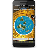
This is a version of my Yin Yang Radial Oscillator model which lets you choose a date and time by tapping the date shown, and it will show you the sun and moon positions relative to stars and Earth. Before the globe shills noticed it and moved in to downrate and discredit it, it had an average rating of 4.9! I just tried to make a Facebook page for the app and Facebook UNPUBLISHED the page less than ten minutes later and blocked me from their site! So there must be something interesting here... ! I love it when they are forced to show their hand.NOTE: This app integrates a Google Map fragment for the aerial view and so it depends on Google Play Services. If you have problems with this app make sure you have Google Play Services installed first. https://play.google.com/store/apps/details?id=com.google.android.gms
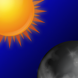
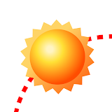
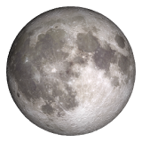
You can pinch to zoom and pan. The yin yang shows areas of night and day. So you can check where and when the sun will rise and set, and see which constellations are visible and where. The red dot shows the centre point of the moon and sun. It also shows world cities with populations >1m and which is nearest to sun and moon. You can toggle all the plates (Earth, stars, cities) on and off as well as whether the display is static or animated by a clock. Now also includes a Moon Compass and daylength calculated from the model time and your latitude if you (optionally) allow GPS permissions. You can lock the screen to North, so that upwards is North, or lock it to the compass so the map orients itself to match your North in real time. Sun and sun shadow pointers display when the Sun is in visible range of you. When used in Compass Lock the Sun and shadow pointers should align approximately with your reality! Why not use it to make a sundial! It is a sundial! Align your device with the sun shadows and press Shadow Check to see precisely what time after solar noon is implied by the bearing of the shadows. You can also optionally display live flights updated every 5 seconds. Unfortunately this only covers Europe but it shows 700 or so flights typically. Today's weather and forecasts can be displayed shown at your location. You can now press the teleport button to jump to any of hundreds of cities to see the model and weather information from their location. Now includes Aerial View which shows detailed zoomable aerial photography on a regular projection, from which you can select a city and switch location to it, or long click anywhere on the world map to select your location in the model. It also now optionally shows you the sunset/sunrise and twilight times from an independent source sunrise-sunset.org at your selected time and place so you can compare the result easily. In response to feedback Version 2 just released has has a layout change which I hope makes it work for tablets and phones... I can only test on an emulator. This application scores over mainstream scientific application in two regards, firstly it is slightly cheaper and secondly it now includes a friendly DON'T PANIC button in case what you see causes uncomfortable cognitive dissonance, which will show you over 130 of my flat Earth videos, directly in the app. You can also choose to show over 8,000 airports.
Also you can now view an overlay of historical flight route data on both the AE and "normal" map.
You can use the new distance calculator feature which calculates the distance between any two selected locations in the world and shows you both the flat and sphere model distances for comparison, and marks the lines on bothe the AE and Goole projections.
Now also features optional layers for know ultratall structures (used as radio masts) and for buoys. These are clickable on the aerial view to get latest air and water temperatures as well as wind sped and direction. Data feed from the US NDBC.