0.0
0 review
Everyone
Content rating
243
Downloads


About this product
On2go Surveying App for GNPS System description
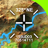
The On2go app for the GNPS system, of Gottlieb Nestle GmbH, is an application for mobile satellite positioning in real time (RTK). It serves to record and stake out points in topography, documentation, construction and volume measurements.The app offers simple calculations for lengths, distances, height differences, area and volume determinations directly in the field.
Numerous of formats are available for import and export:
- dxf
- txt
- csv
- kml
- apl
- apg
- shp
- xyz
The app can also save data in landxml format.
The very easy-to-learn app On2go processes satellite data from GPS, Glonass, Galileo and Beidou for positioning with cm accuracy (RTK) and is therefore suitable for many measurement applications for everyone.


![ReachView [Deprecated] icon](https://play-lh.googleusercontent.com/YwzE9XN5dQE-0Aq3hnF9Di_kBqCAleoiI-u-Weo5Ocwu_0XCfVTbZ600qbqtWGzPBw=s160-rw)