2.8
58 review
Everyone
Content rating
20.6K
Downloads


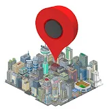
Map Point Augmented Reality description
With Map Point we can save locations on the map and locate them using Augmented Reality in the Camera View.You can assign an icon, and save your favorite way points getting the Latitude, Longitud and Elevation.
With the multiple icons you can save your favorite restaurants, landscapes, POis or anything you want and share all the stuff on your social networks (facebook,twitter, whatsapp and so on).
Map Point consists of the following views and functions:
- Map view
The map view allows us to create points with a selected Icon from the library and move them to the desired position, either map view or satellite view. For each of the points on the map you can obtain the following information: Name, Latitude, Longitude and Elevation.
- Camera view
The camera view allows us to see the close points (up to 10km away) with respect to the current position by Augmented Reality. As we move the relative distance to the points is updated in real time.
The view displays at all times our position (latitude, longitude and elevation) and the accuracy of the data obtained by the mobile GPS sensor.
This view also have a bar to adjust the zoom depending on the distance we meet the points so as to adjust the camera view accuracy.
The view also has a radar that can see the points within the range set by the zoom bar.
Clicking on the icons displayed shows the detailed information of the marker.
- Map point markers
This functionality allows us to navigate to point markers just with a click and delete the obsolete ones.