3.9
142 review
Everyone
Content rating
0
Downloads


About this product
London Transport Maps description
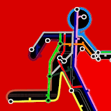
London Transport Maps with offline access- The latest London Tube Map
- Night tube map
- Tube Journey Times (approximate time to travel between stations)
- London tube and rail map
- Tube station toilets
- Walking time between stations map
- London bus maps including Central London, North West, North East, South West, South East London - full daytime bus and night bus map
(includes option to download higher resolution bus maps - this option would require an internet connection)
- City tourist map - (Official City Guide)
- Bicycle on the tube map - shows lines that allow you to carry folding/non folding bikes
- Transport For London Tube Accessibility Map (step free) disability & wheelchair access
- Tube Station escalators and lifts (stair free map)
- Congestion charge zone map
- Thames Clipper River bus map including tourist attractions
- London Overground map
- London tramlink map
- Cycle lanes and bicycle superhighways maps
- DLR train map
- London boroughs/towns (mapped over the tube map)
A simple handy app to carry around all the useful public transport maps in your pocket - let us know what maps you would like to see added!
Maps with credit to TFL, Mark Noad & Stefano Maggiolo
Email [email protected] with any issues/requests