4.6
22 review
Everyone
Content rating
2.1K
Downloads


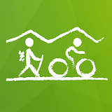
Laško2Go description
Laško2go is a mobile guide for planning trips, hiking and cycling tours in the Laško area. The application features information about themed hiking trails, trails suitable for cycling and Amber Road. You can also find a detailed map of the Laško area and top 50 attractions in Slovenia, such as Postojna Cave, Ljubljana Caste and Lake Bled.Trails are described in detail with: length, estimated time, level of difficulty, description of the trail, photo of the blaze, elevation data with elevation profile and nearby points of interest. Each trail is checked and verified whether it is family friendly, how much of the trail leads through the forest, main and side roads.
The application encompasses:
THEMED HIKING TRAILS
• Mountain trail to Šmohor
• The Rečica loop mountain trail
• Mountain trail to Kopitnik I and II
• Mountain trail to Veliko Kozje I and II
• Trail to the peak of Hum
• Spa trail
• Three churches trail
• The trail along the old Laško market town borders
• The Aškerc trail
• Trail from Sloge to Log
• Energetic trail to st. Trinity
• Orion's trail
• Perkmandeljc forest educational trail
• 2 km Walk Test
and
TRAILS SUITABLE FOR CYCLING
• 1. Junior
• 2. Vrh nad Laškim
• 3. Trobni Dol
• 4. Šmohor
• 5. Lisca
• 6. Govce
• 7. Celjska koča
• 8. Šentrupert
• 9. Laško round trip
Trails and points of interest are shown on a detailed topographic map (Monolit maps are widely used in different GPS navigation devices).
Main advantages of the Laško2go app:
- You can save data for the selected trail on your mobile phone’s internal storage and use it even without a network connection.
- You can view your current status on the trail and a distance to finish.
- You can search or browse more than 30,000 points of interest, e.g.: top 50 Slovene attractions, natural and cultural attractions, restaurants and mountain huts. All interesting points of interest include detail description with photos.
Application is currently available in Slovene, English, Italian, German and Russian languages.