3.6
41 review
Everyone
Content rating
10
Downloads


About this product
Altimeter Maps, Compass & Route Planner description
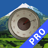
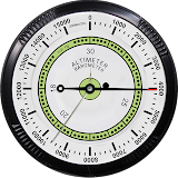
GPS Altimeter maps & compass app is for people who want a hiking and biking in huge mountainous terrain. Accurate GPS is getting accurate location in terms of distance indication, speedometer & compass. GPS Altimeter maps & compass application is best for measurement the altimeter (altitude & longitude). Make routes on map, grid view map and satellite view of map. The auto strong barometer measures the weight of the air pressure determines the elevation of two points. GPS Altimeter map & compass app has a created with simple style design and comprehensive functionalities.Calculate your traveling speed on offline speedometer or GPS odometer. GPS Altimeter maps & compass application performed many features in one time like compass direction, latitude & longitude, offline speedometer, GMT timer, altitude meter free, current date, sunrise & sunset time, air pressure, wind & take a picture with different effects. In this GPS Altimeter map & compass app, you can zoom in & zoom out a map for see the nearby places.
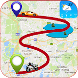
Navigate on map with facility and easy driving with this live GPS location route map and live GPS navigation & transit app. Real-time traffic data and live traffic information will let you choose your route direction. Live satellite location route map with real-time navigations on traveling map will be helpful for you to have easy road journey. Get directions and start your journey on shortest route as route planner and route optimizer will draw shortest and fastest route for you.
This live navigation tool & free GPS maps app will give you accurate directions and you can also know live traffic updates & traffic conditions and draw easy route with this GPS shortest route finder & traffic routes live map guide app. Automatic re-routing will redraw your driving route. Find your current address location on locator map. Place finder with real-time GPS location will tell you your exact live location in this free maps & GPS navigation app.
With this GPS, Maps, Live Satellite & Street view app, you can easily navigate on the map. Find best possible & shortest route on map with this traveling map & GPS navigation app. Live satellite map will let you explore the world and route finder will find best driving directions for you.
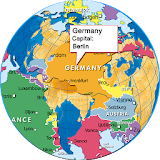
Street View Maps app provides global world maps with street view. GPS Altimeter & Compass app makes routes between two locations from your current location to favorite destination & guide to users with street view, direction & updates your maps & direction turn-by-turn. Street view map & compass altimeter app provide the navigation during route with voice instructions of path. With street panorama view feature of this panorama 360 app, you can see street views of your favorite countries like USA famous places, UK visiting areas, Japan cultural places, Canada beautiful places, UAE tourist areas, beautiful places of Norway, amazing places of Germany, tourist places of France, Holy places of Saudi Arabia, cultural places of Hong Kong and in simple words, fantastic and most amazing tourist areas and fantastic places of all over the world.
This routes & journey guide map app provides amazing features for traveling. if you want to see your traveling route then you will start travel to your destination and favorite place. Find nearby & near me feature is very helpful to explore nearby places like Gym, Food point, ATM, Bus station, Railway station, Airport and Gas station etc. this map makes a route & direction car, walking & transport
Search any place of earth on the satellite map
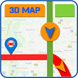
Map integration
Satellite map mode
Hybrid map mode
Street view map mode
Compass
- GPS Compass
- Show the Latitude & longitude
- Latitude and longitude
Get information
- show Current GMT time
- Show route Distance.
- Barometric Pressure
- Show your moving Speed Offline & GPS speed Measurement
More from Developer

Photo to Video Maker with Songs & Video Editor
↓25M
☆4.01
GPS Earth Camera - Satellite Maps & Street View
↓3.4M
☆3.87

Live GPS Satellite, Traffic & Earth Maps Navigate
↓6.1M
☆3.52
Local Language Navigation Maps: Voice Direction
↓
☆4.81
Navigation Route Maps: GPS Path Finder
↓
☆4.63
Live Route Tracking Maps: Navigation & Weather
↓
☆4.50