4.1
830 review
Everyone
Content rating
126.8K
Downloads


About this product
Trailblazer GPS: Offline Maps description
Use Trailblazer GPS to navigate trails, waterways and wilderness areas. Download a map before travelling beyond network reach and use it to keep you oriented anywhere on the planet! Record your hikes, runs and bike rides with the app's track recorder and create waypoints with the app's location logging tools.Maps
Trailblazer GPS has maps for every situation. Explore mountains and national parks with topographic and hiking maps. Find and explore biking trails with our cycle maps and navigate coastal areas with NOAA nautical charts. Our offline maps are perfect for back country hiking and cycling. Offline maps can be downloaded and transferred to the SD card to save phone memory and are always free. View your previously recorded trails and waypoints on any map or add trails and waypoints from a kml or kmz file. All maps have custom built-in compasses and measurement tools to enhance your location awareness.
Location Recorder
Save your current location, enter coordinates or use a map to create a waypoint. Multiple coordinate formats including UTM can be entered. Navigate to any saved location using maps or the app's location-finding compass where you simply follow the arrow along a straight line course to your waypoint.
Trail Navigation
Record a track and follow it on your return trip or navigate along a trail included on the maps. If you have a trail in a kml or kmz file, you can also add that to any map and navigate with it.
Weather Maps
• Animated Live Doppler Weather Radar.
• Weather Satellite Layer (visible clouds and infrared imaging).
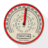
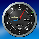
GPS Parameters and GPS Signal Diagnostics
Navigation accuracy is only as good as the information that comes from your GPS chip. Use the app's GPS reports to understand the accuracy of your location information and the quality of the GPS signals received by your phone. For our more technically oriented users, the app offers graphs and charts that describe GPS signal quality and satellite location in greater detail.
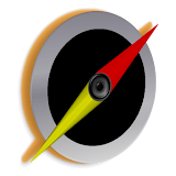
Compasses
Magnetic compasses, GPS controlled compasses and waypoint compasses are all there to give you that extra bit of navigation information that cannot be provided by a map alone. All magnetic compasses feature gyroscopic stabilization on compatible devices for super smooth operation.
KML / KMZ Viewer
Add tracks and waypoints from any kml or kmz file and navigate them.
Explore the app and you will be surprised by the number of useful navigation tools that are available.
GPS Navigation couldn't be easier or more fun!