0.0
0 review
Everyone
Content rating
19.6K
Downloads


About this product
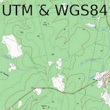
EZ GIS ( XY GPS & Topo tool ) description
EZ GIS is the easiest application to obtain, export, and use your geographic coordinates or location, in various formats. (Latitude / Longitude, DMS Degrees Minutes Seconds, WSG83, WSG84, UTM, OSGB36) with an accuracy of up to 1 meter. Ideal for land surveyor, topographic surveying, or mapping worker.This GIS, topographic tool, cartographic tool or location tool is compatible with QGIS , ArcGIS , GRASS GIS , gvSIG , Manifold GIS , ILWIS , JUMP GIS , MapWindow GIS , SAGA GIS , uDig , Capaware , FalconView , Kalypso , TerraView , Whitebox GAT , MapGuide , Mapnik , MapServer , PostGIS , SpatialLite , TerraLib , Cesium , GeoTools , GDAL , Orfeo toolbox , GeoNetwork , pycsw , Chameleon , MapPoint , Google Earth , Autodesk , ENVI , ERDAS IMAGINE , Esri tools , GeoServer & Excel
Localization tool / topo tool specifically developed for archaeological and geographical exploration. work on your carto, or map will become easier! use your position and your coordinate points, lat lng and more!
This location tool the new research tool for cartography, topography, map work, scaling & leveling
You can say goodbye to expensive XY GPS
The application lets you record your positions in two different ways.
First, manual mode , it leaves your hand and you need to manually retrieve your different geographical points coordinated to my demand (ideal for referencing specific areas).
Secondly, an automatic mode or tracker that tracks your movement and backup recording data every X seconds can track your movement and view them on a map (ideal for trips reference)
This location based software allows you to export files in CSV format readable in most mapping or GIS software and in KML file format that can be read directly on Google Earth,
Moreover EZ GIS offers you the ability to view your plot or export your recorded movement on a map googlemaps.
The map allows to display your data in the form of polygon or line or just under marker form
Get your data and watch it live on map !
An excellent application of localisation to replace expensive GPS XY and make GIS easy
This GIS application / Carto app has been specially developed for use with maps software and GIS tools like QGIS, ESRI ArcGIS, or Manifold GIS , ArcGIS , GRASS GIS , gvSIG , Manifold GIS , ILWIS , JUMP GIS , MapWindow GIS , SAGA GIS , uDig , Capaware , FalconView , Kalypso , TerraView , Whitebox GAT , MapGuide , Mapnik , MapServer , PostGIS , SpatialLite , TerraLib , Cesium , GeoTools , GDAL , Orfeo toolbox , GeoNetwork , pycsw , Chameleon , MapPoint , GoogleEarth, Google Earth , Autodesk , ENVI , ERDAS IMAGINE , Esri tools , GeoServer & Excel to read CSV files. So what is the essential tool for your mapping archaeological surveys and geographical surveys.
WKT data or traditional
In addition, for new users QGIS, EZ GIS offers a step by step tutorial to import your data in QGIS and facilitate the use of data.
This application is going to be your best friend if you do archeological survey and/or geological survey or simply work on mapping and use CSV or KML file format.
Get your coordinates!